

Emergency agencies face increasing challenges when managing wildfire risks across forests, mountains, and other complex environments. Traditional monitoring methods often struggle with limited coverage, delayed information, and difficulties in accessing dangerous areas. As a result, advanced digital solutions such as fire risk assessment software are becoming essential tools for improving prevention, detection, and rescue operations.
For organizations evaluating emergency technology investments, selecting suitable software requires more than checking basic monitoring functions. The system must combine accurate data collection, intelligent analysis, real-time communication, and reliable decision support. Icecypress Technology provides spatial intelligence solutions based on 3D and AI technologies, helping emergency teams achieve better situational awareness and more efficient wildfire response.
What Should Emergency Agencies Expect from Fire Risk Assessment Software?
Modern fire risk assessment software is designed to transform complex environmental information into actionable insights. Instead of relying only on manual inspections or delayed reports, emergency teams can use AI-powered systems to monitor changing conditions, identify potential fire threats, and support rapid decision-making.
A professional solution should integrate multiple data sources, including aerial imagery, geographic information, environmental conditions, and real-time field observations. This combination enables agencies to understand wildfire development patterns and prepare response strategies before situations become uncontrollable.
For emergency organizations, the value of such software lies in creating a complete workflow from early warning to rescue coordination. The right platform should not only detect risks but also help teams understand fire locations, affected areas, and the safest response routes.
Key Factors to Consider When Selecting Fire Risk Assessment Solutions
When evaluating fire risk assessment technologies, emergency agencies should first consider detection accuracy. Wildfires can spread quickly, and delayed identification may lead to significant environmental and economic losses. AI-based recognition technology helps analyze visual information and identify abnormal conditions more efficiently.
Another important factor is real-time data processing capability. Large volumes of aerial images and geographic data can create heavy transmission pressure. Advanced systems reduce this challenge by processing information closer to the data source and transmitting only valuable results.
Icecypress Technology applies onboard AI processing and drone collaboration technologies to improve operational efficiency. Its solutions support real-time reconstruction, precise positioning, and intelligent analysis, allowing emergency teams to access critical information faster.
Scalability is also important for emergency agencies managing large forest areas. A reliable platform should support different types of drones, communication environments, and operational requirements. Multi-drone collaboration allows teams to expand monitoring coverage while maintaining coordinated operations.
How AI and Drone Technology Improve Wildfire Risk Management
The combination of artificial intelligence and unmanned aerial systems is changing how emergency agencies approach wildfire management. Traditional patrol methods require significant manpower and may leave areas without continuous monitoring. Drone-based solutions provide a flexible approach for covering challenging terrain and collecting real-time information.
Icecypress Technology’s forest fire detection and emergency rescue solution integrates infrastructure, communication networks, and application systems into a complete architecture. The solution includes portable ground equipment, intelligent UAV management platforms, communication equipment, visualization systems, and cooperative UAV swarm task planning.
Through heterogeneous drone swarm collaboration, different drone types, including multi-rotor, fixed-wing, and hybrid drones, can work together. Intelligent task allocation optimizes coverage efficiency, while autonomous obstacle avoidance supports operations in complicated environments.
This approach helps emergency agencies move from reactive firefighting toward proactive risk management. Instead of waiting for a fire to become visible through traditional methods, teams can continuously monitor environmental changes and prepare targeted response plans.
Real-Time Mapping and Precision Positioning for Emergency Response
Accurate location information is critical during wildfire rescue operations. Emergency teams need reliable maps to understand terrain conditions, identify affected zones, and coordinate personnel and equipment.
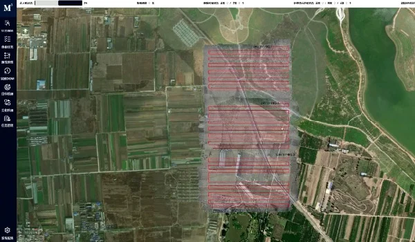
Advanced fire risk assessment software combined with 3D modeling technology can generate detailed digital representations of fire scenes. Icecypress Technology uses real-time mapping capabilities to create centimeter-level DOM outputs during flight, providing detailed spatial information for wildfire analysis and emergency decisions.
The company’s AI wildfire detection system also combines GPS and visual positioning technologies to achieve sub-meter accuracy. This capability supports precise target classification, location tracking, and continuous environmental change monitoring.
For rescue agencies, these functions can significantly improve operational awareness. Teams can evaluate hazards more accurately, optimize deployment strategies, and reduce unnecessary risks for frontline personnel.
Building a Complete Emergency Response Ecosystem with Spatial Intelligence
A successful wildfire management system requires more than individual detection tools. Emergency agencies increasingly need integrated platforms that connect data collection, communication, analysis, and field operations.
Icecypress Technology focuses on building a digital foundation through independent core technologies in 3D and AI. Its spatial intelligence solutions connect low-altitude data, drone photogrammetry, and AI analysis to support applications such as forest firefighting and emergency rescue.
By combining drone swarm collaboration, real-time situational awareness, and intelligent processing, the company helps emergency organizations establish a more efficient workflow. From early fire risk assessment to precision search and rescue, integrated systems can improve response speed and decision quality.
Making the Right Investment Decision for Future Emergency Operations
Choosing fire risk assessment software requires emergency agencies to look beyond basic monitoring functions. The ideal solution should provide accurate detection, fast data processing, flexible deployment, and strong integration capabilities.
As wildfire risks continue to evolve, digital technologies will play a larger role in protecting ecosystems and human communities. Icecypress Technology demonstrates how spatial intelligence, AI, and drone collaboration can support next-generation emergency response systems.
By adopting advanced fire risk assessment solutions, emergency agencies can strengthen prevention capabilities, improve rescue efficiency, and build a smarter approach to wildfire management.
